Facts
Facts
Mt Damavand Facts And Figuers
Some useful and interesting facts and figuers mainly focused on south route, base camp to the summit .
Abstract
Base camp to Summit
- Average ascend Time 10 hours
- Average climb speed 800 m/h
- Trail path distance 8000 meters
- Altitude gain base camp to summit 2630 m

Facts And Figuers about Mt Damavand
By Mount Damavand Guide
Detail
Camp2 Base to Camp3 Bargah
- Average ascend time 4 h
- Average climb speed 1175 m/h
- Trail path distance between camp2 and camp3 4700 m
- Height from camp2 to camp3 1160 m
- Direct distance between camps 3182 m
- Avarage slope angle 21.8 deg
- Max slope angle 33.3 deg ( from 3807 m to 3861 m )
- Min slope angle 11.5 deg ( from 3095 m to 3115 m )
Camp3 Bargah to Summit
- Average ascend time 6 h
- Average climb speed 55o m/h
- Trail path distance between camp3 and summit 3300 m
- Height from camp3 to summit 1470 m
- Direct distance between camp3 and summit 2687 m
- Avarage slope angle 31 deg
- Max slope angle 39 deg ( from 4910 m t0 4973 m )
- Min slope angle 12.7 deg ( from 5522 m to 5544 m )
Over All Measurements
For Base camp to Summit
- Average ascend time 10 h
- Average climb speed 800 m/h
- Trail path distance between camp2 Base and summit 8000 meters
- Direct distance between camp2 Base and summit 5840 m
- Avarage slope angle 26.76 deg
- Max slope angle 39 deg ( from 4910 m t0 4973 m )
- Min slope angle 11.5 deg ( from 3095 m to 3115 m )
- Camp1 Polour Altitude 2270 m
- Camp1 Reineh Altitude 2070 m
- Camp2 Altitude 3040 m
- Camp3 Altitude 4200 m
- Mt Damavand Summit Altitude 5671 m
- Camp1 Polour to Camp2 Base distance 17.7 Km
( 11.3 Km asphalt road + 6.4 Km gravel road )
- Tehran ( Serah TehranPars ) to Camp1 Polour distance 73 Km
- Tehran IKA Airport to Camp1 Polour distance 133 Km
- Because of its accessibility by car, distance between camp1 and camp2 base is excluded in some measurements.
- Different equipments like hand held GPS, softwares and some available maps are used in these measurements and I hope it is accurate enough to some extent.
Quick Facts
Farsi Name:
Koh Damavand alternate Donbalvand , Dood koh ,Koh Damawand
English Name:
Mount Damavand or Volcano Damavand, Damavand Volcano
Alternate Spell:
Mount Damawand , Damawand , Demavand , Demavend....
Location and Coordinate
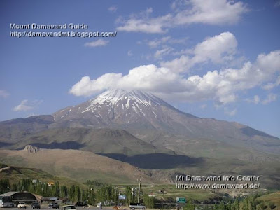
central Alborz range mountains Iran 80 Km North- East of Tehran
Altitude: 5,671 m - 18,605 ft see also GPS Landmark
Latitude: 35° 57' 19" N
Longitude: 52° 06' 36" E
Best place to get info : Mount Damavand Guide
Best Climbing Time: 10 June To 20 August
Best Climbing Side: South face
Best Climbing Program: 2 or 3 days
Best Start point: Polour, a small village at the south side of the Damavand
First Climbs : We believe there has been may unrecorded climbs in ancient years
First Recorded Climbed: 1837 by W.T Thomson
Status: not active also see: Volcanic Activity of Damavand
Most Recent Eruption: None on record
Nearest International Airport: MehrAbad or IKA Airport Teheran, Iran

5671m
Damavand
Summit of Iran
Summit of Middle East
Highest Volcano in Asia and Europe
Second Highest Volcano in The North Hemisphere
More in MDG
Mt damavand difficulty, toughness, and climbing grade, wintwer ascend tour, summer hiking and trekking, tips and tricks, damavand tour 2010, photo and video, volcanic activity, weather, winter climb, world heritage, ski, skitour, news, faq, route map, volcano damavand.
Facts And Figuers MDG880125D
Copyright © Mount Damavand Guide . All rights reserved.
Labels: Facts
0 Comments:
Post a Comment
<< Home